
OpenStreetMap’s mission is to make one free, public map of the world, so it doesn’t offer much in the way of creating custom maps with OSM data. Mapbox Studio is a good way to do that. Despite being billed as a tool for cartographers, devs and designers, it’s straightforward enough for regular folks with some tinker time on their hands to make simple custom maps. (We’ve also tried uMap – and are definitely open to suggestions!)
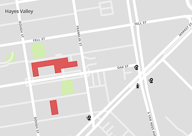
As part of the emergency map project, we’ve started adding standalone fire alarm call boxes to OpenStreetMap. There are about 2,000 of these in San Francisco — and despite recent reports that a significant number are out of order — they are one form of emergency communication that should work after a major event. Our proposed tag for them (emergency: fire_alarm_box) was accepted.
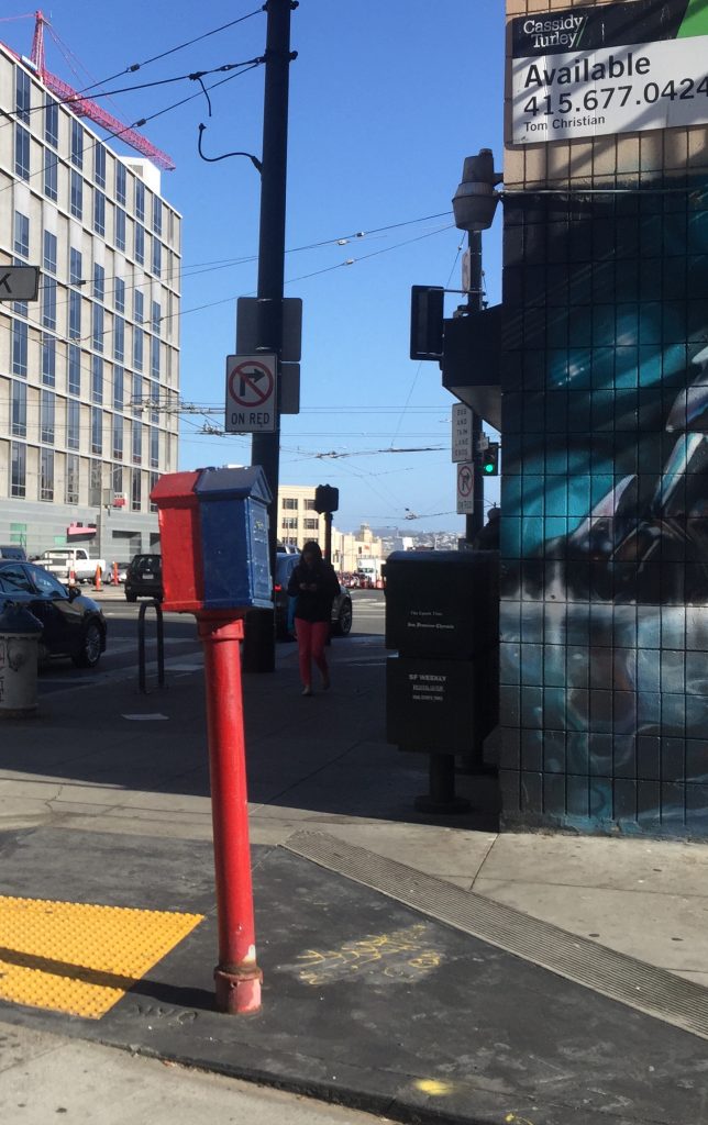
Creating a map of the first fire alarm boxes that we added seemed like a good way to try out Mapbox Studio.
Step one is to create a new dataset: https://www.mapbox.com/help/add-points-pt-1/. Then to query OSM, we used Overpass Turbo for a GeoJSON to find all fire_alarm_box features currently mapped in San Francisco https://overpass-turbo.eu/#
Overpass query:
/*
This was generated by the overpass-turbo wizard.
The original search was:
“"emergency"="fire_alarm_box"”
*/
[out:json][timeout:25];
// gather results
(
  // query part for: “emergency=fire_alarm_box”
  node["emergency"="fire_alarm_box"](37.707998069120265,-122.52406311035156,37.83337825839438,-122.34306335449217);
  way["emergency"="fire_alarm_box"](37.707998069120265,-122.52406311035156,37.83337825839438,-122.34306335449217);
  relation["emergency"="fire_alarm_box"](37.707998069120265,-122.52406311035156,37.83337825839438,-122.34306335449217);
);
// print results
out body;
>;
out skel qt;
The result is a GeoJSON file that can be imported in Studio to create a new dataset. https://www.mapbox.com/help/add-points-pt-1/#about-datasets
Mapbox Studio allows to you assign new icons to the dataset and we used the awesome https://glyph.smarticons.co/ SVG icons. The fire alarm icon looks great and the overall results are pretty good. This is a fairly simple way for individuals or neighborhood groups to highlight the features they want on their maps while contributing to OSM.
One thought on “Making custom OpenStreetMaps with Mapbox Studio”