SAN FRANCISCO — In the tech capital of the country, we’re promoting the use of paper maps. It sounds like a Luddite proposition but was a great way to introduce people to Resiliency Maps.
I found this out by printing some up and handing them out at the recent Earthquake Safety Fair. Organized by the San Francisco Department of Building Inspection, about a 1,000 residents stream through the Bill Graham Civic Auditorium to take workshops and learn more about preparedness from government agencies, non-profits, engineering outfits and community groups like RM.
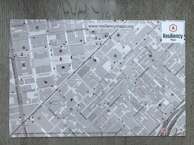
Out of my own palpable terror at sitting behind an empty table all day, I headed over MyOSMatic to print out two neighborhoods — the Marina and Civic Center — for people to mark up and put in their go bags. (These were done quickly without time to see them live and reprint —there’s a wide margin for improvement.) The black-and-white versions measure 12 x 18 (28.19 x 43.43 cm).

They were a huge hit! Having something tangible went a long way to getting the message across, there were only a few times (again, surprising in uber-wired San Francisco) that we had to spell out that in an emergency, digital maps might be hard to access or inaccessible, period. The analog approach hit home better than expected: we’re working on a couple of pitches to make print maps for local groups. The other unscientific takeaway is that interest equally split between printing out blank neighborhood maps and making maps with hazards and assets clearly marked.
Just about ready for the #SFEarthquakeFair 6/11! Come find out more about making @resiliencymaps & grab a sticker. https://t.co/ZKBXOJVtYp pic.twitter.com/5fdsIM11oL
— Resiliency Maps (@resiliencymaps) June 10, 2019
Show and tell
We also cobbled together the banner in the cover photo. (See: empty table terror above.) It needs work — a tag line and better layout, for starters — but like my journalism professor used to say, it does the job of “show don’t tell.” You can see what assets and hazards look like on a printed map, with the first version of the Resiliency overlay kindly designed by MyOSMatic’s Hartmut Holzgraefe. The cool thing about open source being, well, open, is that a few other folks have used the Resiliency overlay to make their own maps. The banner, from left to right, shows Ottawa, San Francisco, Digne in France and Port Vila, Vanuatu. Again, seeing how you might mark up or visualize your own map went a long way to getting people interested.
The literacy hurdle
To really get Resiliency Maps to the people who need it most, the way we think about reading and understanding maps has to change. There are a couple of interesting scenarios that people brought up that will chart our course in the coming months.
Maps need to work without words. One community advocate told us that it wasn’t even a question of translations, many of the people who need the information most wouldn’t be able to written instructions or a key. (To direct people to cooling centers in the most recent heatwave, they drove around with loudspeakers telling people where to go.)
It takes a village. It’s come up before but at the Fair we talked to a number of folks who represent or manage retirement homes or senior care facilities. For these groups, going outside and mapping with pen and paper (see tutorial) is unlikely to be a viable way to get RMs into their hands. We’re interested in recruiting volunteers to make maps for these groups and developing a process for mapmaking for groups who can’t DIY. Get in touch!
And, lastly, the literacy problem isn’t always where you’d think to look for it. A woman in her 20s — stopping by with her mom, who remembers the 1989 quake — admitted she doesn’t know how to read a map. “If it’s not telling me where to go, I have no idea.”

One thought on “Takeaways from the Earthquake Safety Fair: Map literacy and the value of paper”