
SAN FRANCISCO — Everyone should tuck a paper map into their emergency kit. When power goes out and cellphone networks are down, having a clear view of your surroundings is crucial.
These paper maps were designed as a pilot project for the San Francisco Fire Department Neighborhood Emergency Response Team (NERT) to give area coordinators and team members a much-needed planning tool as well as a go-bag map.
Working with Capt. Erica Arteseros, the main constraint that emerged was simplicity. For planning purposes, neighborhood coordinators needed to a quick overview with the minimal detail. After an emergency, teams could also mark up the maps for damage reports.
Minimum viable maps
That meant turning the volume way down on what you see in most maps: Transit stops, stoplights and a generous sprinkling of icons. Useful information if you’re planting a pin for an Uber ride or figuring out which bus stop is closest to Safeway, in an emergency, not so much.

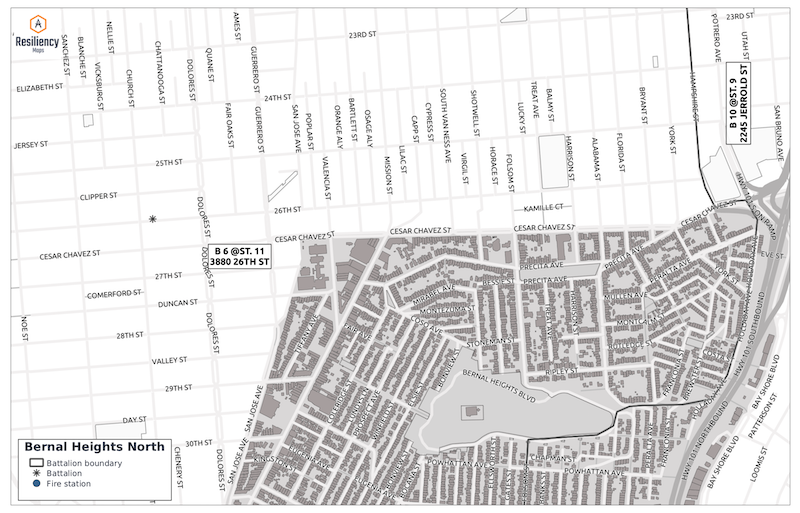
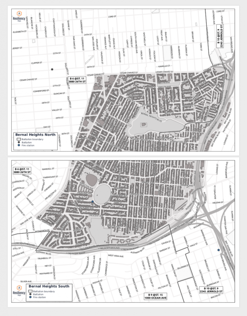
The maps need to highlight only the data that matters. In this case, that’s just four things: Neighborhood boundaries, building outlines, fire stations and the closest fire station battalions. (Battalions are fire stations designated to stay open after a major event. More often than not, they’re outside the neighborhood boundaries that they serve.)
These workhorse maps also had to render in black and black-and-white, print to 11×17 inches and expand to 24×36 with consumer-grade printers, no specialized equipment required.
The format had to encompass larger neighborhoods, printing on two pages that could be stitched together, as in the North and South Bernal maps.
Given this mandate, cartographer Andrew Middleton started from the ground up. Instead of stripping layers of information down, he used datasets from DataSF, the city’s open data portal. Then it was time for QGIS, a free, open-source cross-platform desktop geographic information system, to build the maps — cartography layout and all. QGIS is extremely powerful, even compared to commercial counterparts, although it turned out that assembling the layers was the easy part.
Laying out any map for print always adds a level of frustration, and the fine employees at nearby FEDEX and UPS stores became a vital part of the proceedings as we tested printer settings and tweaked formats. (“You again? What now? Let me take a look.”)
The devil is truly in the details, in this case: labels. We wanted the placement to be dynamic, since we were not printing only one map but ideally all the neighborhoods of San Francisco.

In early attempts, these maps looked great on the monitor. Once printed, labels for some of the geographic features shrank or expanded for a crazy-making effect with letters pushing together and names eating up the entire street. Battalion labels that appeared straight printed at jaunty angles.
Things got a little darker when we noticed that the maps varied slightly depending on the machines we used to print them. Since they needed to print reliably from any standard printer, it was back to the drawing board to tweak dozens of QGIS labeling options. We eventually got the street names to stay in their lanes, the labels for the battalion boundaries to display and rotate correctly.
Then we handed the maps over with a little jig in honor of the streets of San Francisco.
It was a pleasure to work in our hometown and in partnership with NERT. The idea for Resiliency Maps came from my own experience as a NERT who needed a map. Having input from Capt. Arteseros to make these maps for the larger community was extremely valuable.
We’re looking forward to making more of these maps. Get in touch if you’d like us to make them for you!
5 thoughts on “Making distraction-free maps for community responders with open source tools”